Hiking and mountaineering

Winter hikes

Hiking in summer

Hiker's paradise with a view of the Dolomites

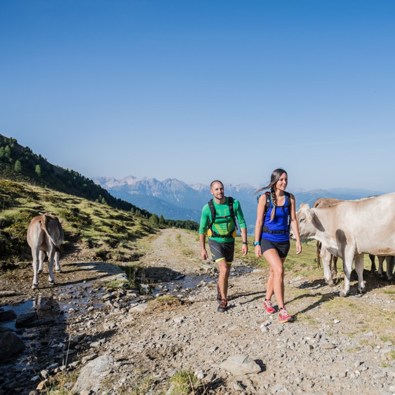
Those who go hiking in the Val Casies Valley get closer to nature with every step. Whoever hikes up to the Malga di Tesido-Taistner Alm and to the rocky peak of the Roda di Scandole-Rudlhorn is rewarded with a view of dizzying beauty of the valley below and the other mountains. Little hikers can also make it to the first meadow of the Malga di Tesido. This is where the Tyrolean Knödel dumplings are steaming and the smell of the Krapfen fritters wafts far in advance, making it pretty much impossible for any hiker to pass by without stopping. The Almweg 2000 path connects together several of the Alpine meadow inns of the valley that are operated with passion, also offering fabulous views both up and down the valley. Many family hikes.

The holiday area Val di Casies Monguelfo Tesido is situated in a quiet location and yet in the immediate vicinity of the famous Three Peaks and the beautiful Pragser Wildsee lake.

Active Programme Summer Alpine and Refuges
HIKING IN SUMMER
Our most beautiful hiking tours
Winter hike: Hiking from Monguelfo to the dam of Valdaora
Distance 12,2 km
Duration 4 h 00 min
Ascent 215 m
Decent 215 m
11 Summit Tour
Distance 32,5 km
Duration 12 h 10 min
Ascent 3.139 m
Decent 2.571 m
Status
closed
Mountain hike Lutterkopf Durrakopf | © TV Gsieser Tal_Harald Wisthaler, Dolomite Region Gsiesertal Val Casies
Intermediate
Add to favourites
Mountain hike: Mountain Luta and Mountain Salmone at Tesido (2145 m/2275 m)
Distance 11,7 km
Duration 3 h 30 min
Ascent 712 m
Decent 712 m
Status
closed
To the Staller Saddle
Distance 22,2 km
Duration 2 h 37 min
Ascent 1.024 m
Decent 4 m
Status
closed
Mountain hike: The lakes Ochsenfelder Seen in the Val Casies Valley (2555m)
Distance 12,4 km
Duration 4 h 49 min
Ascent 1.312 m
Decent 5 m
Status
closed
Hiking Tour Valdaora/Olang
Distance 15,1 km
Duration 5 h 18 min
Ascent 1.207 m
Decent 1.213 m
Valdaora - Monguelfo | © Pustertal.org, Olang
Intermediate
Add to favourites
Hike Valdaora di Sopra – Monguelfo/Oberolang – Welsberg
Distance 7,7 km
Duration 2 h 54 min
Ascent 175 m
Decent 137 m
Valdaora|Olang Lake | © TVB Kronplatz, Udo Bernhard, Ski- und Wandergebiet Kronplatz
Intermediate
Add to favourites
Pustertal|Val Pusteria Bike Route: Leg San Candido|Innichen - Brunico|Bruneck
Distance 34,9 km
Duration 2 h 39 min
Ascent 162 m
Decent 510 m
Ski Tour: Monte Luta e Monte Salmone in Tesido
Distance 10,9 km
Duration 3 h 30 min
Ascent 700 m
Decent 748 m
  • 1
Mountain hikes
Our most beautiful mountain tours in summer
Winter hike: Hiking from Monguelfo to the dam of Valdaora
Distance 12,2 km
Duration 4 h 00 min
Ascent 215 m
Decent 215 m
11 Summit Tour
Distance 32,5 km
Duration 12 h 10 min
Ascent 3.139 m
Decent 2.571 m
Status
closed
Mountain hike Lutterkopf Durrakopf | © TV Gsieser Tal_Harald Wisthaler, Dolomite Region Gsiesertal Val Casies
Intermediate
Add to favourites
Mountain hike: Mountain Luta and Mountain Salmone at Tesido (2145 m/2275 m)
Distance 11,7 km
Duration 3 h 30 min
Ascent 712 m
Decent 712 m
Status
closed
To the Staller Saddle
Distance 22,2 km
Duration 2 h 37 min
Ascent 1.024 m
Decent 4 m
Status
closed
Mountain hike: The lakes Ochsenfelder Seen in the Val Casies Valley (2555m)
Distance 12,4 km
Duration 4 h 49 min
Ascent 1.312 m
Decent 5 m
Status
closed
Hiking Tour Valdaora/Olang
Distance 15,1 km
Duration 5 h 18 min
Ascent 1.207 m
Decent 1.213 m
Valdaora - Monguelfo | © Pustertal.org, Olang
Intermediate
Add to favourites
Hike Valdaora di Sopra – Monguelfo/Oberolang – Welsberg
Distance 7,7 km
Duration 2 h 54 min
Ascent 175 m
Decent 137 m
Valdaora|Olang Lake | © TVB Kronplatz, Udo Bernhard, Ski- und Wandergebiet Kronplatz
Intermediate
Add to favourites
Pustertal|Val Pusteria Bike Route: Leg San Candido|Innichen - Brunico|Bruneck
Distance 34,9 km
Duration 2 h 39 min
Ascent 162 m
Decent 510 m
Ski Tour: Monte Luta e Monte Salmone in Tesido
Distance 10,9 km
Duration 3 h 30 min
Ascent 700 m
Decent 748 m
Your persoal summit book
SummitLynx

Collect the famous hiking pins digitally with SummitLynx!

Whether extreme athletes, casual hikers or families - numerous hikes and mountain routes await you in the Plan de Corones holiday region!

Amidst flower meadows, forests, streams and majestic mountains, the vacation region shows its full splendor of varied and diverse hiking opportunities. Scattered throughout the entire Val Pusteria Valley are the destinations that must be climbed in order to achieve the respective hiking pin.

Be there and start with your personal digital summit book!

How does it work?

Download the SummitLynx app from the App Store or Google Play Store and log in. Under the menu item "Regions" you will find an overview of the hiking pins that you can hike in your region. By clicking on a certain hiking pin, you will get to the detailed view and a list of the necessary destinations.

Once you have reached a destination, simply open the app and make an entry (also available offline).
You are free to add pictures and texts to your goal and you have already collected the first points! Turn your points into a great surprise.
Come by the tourist offices in Anterselva, Val Casies Valley, Valdaora, Brunico, Chienes or S. Vigilio and get rewarded for your achievements!